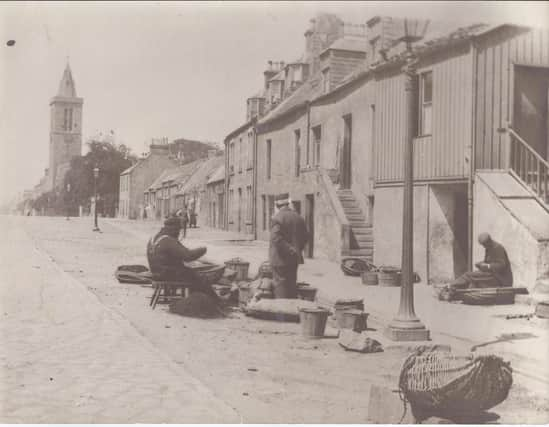
New digital heritage map explores history of Fife town centre


Titled ‘Ladyhead’ – the traditional name for the fishing community that once lived at the east end of St Andrews’ North Street – the map allows users to click on sites and explore the history of the Ladyhead through the St Andrews Preservation Trust archive.
While the map focuses on the once thriving fishing community, material relating to some of the most historic sites in St Andrews, such as St Andrews Castle and Deans Court, is also included.
Advertisement
Hide AdAdvertisement
Hide AdThe map was funded by Museums Galleries Scotland and built by the team at Smart History, a spin-out company from the University of St Andrews.
A map team involving trust staff and seven volunteers worked remotely over lockdown to organise the archive material and add content to the map.
One interesting part of the project for the team was accessing hundreds of historic images of St Andrews, as highlighted by volunteer Hannah Richardson: “A photograph showing a ship being pulled in at the harbour stood out to me as it shows the importance of people and communities coming together to help one another.
"We may not be able to join together in person, but our local and increasingly digital communities have played a huge role in helping us to get through the past year.”
Advertisement
Hide AdAdvertisement
Hide AdThe Trust will mark the public launch of the map by hosting a free online event on Thursday via Zoom. Tickets are available via the trust’s website – standrewspreservationtrust.com/events – and on social media.