UK set to ring in 2023 on ‘wintry note’ with snowfall and downpours as icy ‘jet stream’ blasts Britain
This article contains affiliate links. We may earn a small commission on items purchased through this article, but that does not affect our editorial judgement.
and live on Freeview channel 276
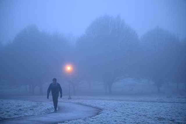
The New Year is set to begin on a “wintry” note for much of the UK, with heavy rain and even snowfall in some areas. The outlook from now until New Year’s Day is mild in the south with intermittent rain, while further north residents are expected to be blasted by much chillier temperatures.
The cold spell in the north of England, Scotland and Northern Ireland is thought to be down to a “jet stream” of icy air making its way over the Atlantic from the US. North America and Canada have endured a deadly “bomb cyclone” in recent weeks, with a deep freeze that killed at least 38 people and left thousands without power over Christmas.
Advertisement
Hide AdAdvertisement
Hide AdWhile conditions won’t be anywhere near as severe for Brits, the weather will likely be unsettled on December 31 and January 1. If you live towards the north of the UK, you might want to wrap up warm or skip the big night out altogether if you’re planning on heading out to ring in 2023.
BBC weather forecaster Stav Danaos said: "It looks like it will be unsettled again across the south, milder here, colder across the north. So for New Year’s Day we start off with some sunshine, an area of low pressure moving across Northern Ireland, Wales, northern England and Scotland bringing outbreaks of rain, some snow on the hills as it engages with colder air but much milder further south."
Heavy rain and flooding hit some parts of Scotland on Friday, December 30, wth people also told to expect snow and ice. A yellow weather alert has been issued in parts of Dumfries and Galloway, as well as the Scottish borders, and warnings have been sounded for rain, snow and ice in other parts of the country.
A yellow warning for rain is in place in much of the central belt and southern parts of Scotland while yellow warnings for snow and ice are also in place across much of the north of Scotland. Some roads and railways will be affected with longer journey times by road, bus and train services and drivers have been warned of potentially difficult driving conditions.
Advertisement
Hide AdAdvertisement
Hide AdThe Scottish Environmental Protection Agency (SEPA) has also issued 10 flood alerts and 20 warnings across Scotland including Pollok Country Park in Glasgow. River levels are expected to rise as a result of heavy overnight rainfall, with levels peaking during daylight hours on December 30.
Met Office meteorologist Simon Partridge said: "The UK weather is going to remain unsettled with further spells of wet and windy weather due to the strengthening of the jet stream because of the weather in the US. The effect it’s having on the UK is nowhere near as dramatic because that system has brought up a lot of cold air further south, across the US.


"Indeed, the cyclone is only having an effect on the UK due to its impact on the North Atlantic jet stream. What effect (the bomb cyclone) has had is to strengthen the jet stream, because the jet stream is basically driven by temperature differences. So the starker the difference in temperature between the northern edge of it and southern edge, the stronger the jet stream becomes."
Mr Partridge added that this “knock-on effect” for the UK, which consists mostly of spells of wet and windy weather, will continue over the next seven to 10 days.
UK weather forecast according to the Met Office
Advertisement
Hide AdAdvertisement
Hide AdFriday (December 30)
Rain and strong winds clearing northwards and eastwards, although persisting across far north with risk of snow over northern Highlands. Sunshine and a few showers following from the west. Mild, except far north. Rain and snow gradually clearing from north Scotland. Further cloud and rain spreading north across southern and central Britain, heavy at times, and clearing in the south later.
Saturday (December 31 - New Year’s Eve)
Band of rain and hill snow moving across northern England then Scotland. Meanwhile, further wet and windy spells in southern Britain - rather mild though.
Rain in the north and far south Sunday, wintry over the Highlands. Else bright or sunny spells, though rain into the west Tuesday. Mild in the south, colder further north.
Comment Guidelines
National World encourages reader discussion on our stories. User feedback, insights and back-and-forth exchanges add a rich layer of context to reporting. Please review our Community Guidelines before commenting.
